

In this work we tend to describe and map groundwater endowment in Algeria. Spatial visualization is presented to categorize the groundwater resource as per its storage, depth and productivity. Furthermore, waterways types and length is presented,as well as monthly precipitation in the country. Finally, challenges related to groundwater resource in Algeria such as water waste and water overexploitation is disscused.
Groundwater is an essential source of freshwater in Algeria for, both, drinking water and irrigation. The actual estimate of groundwater storage reaches up to 91,900 km3. Algeria holds the second largest groundwater storage in Africa after Libya1.
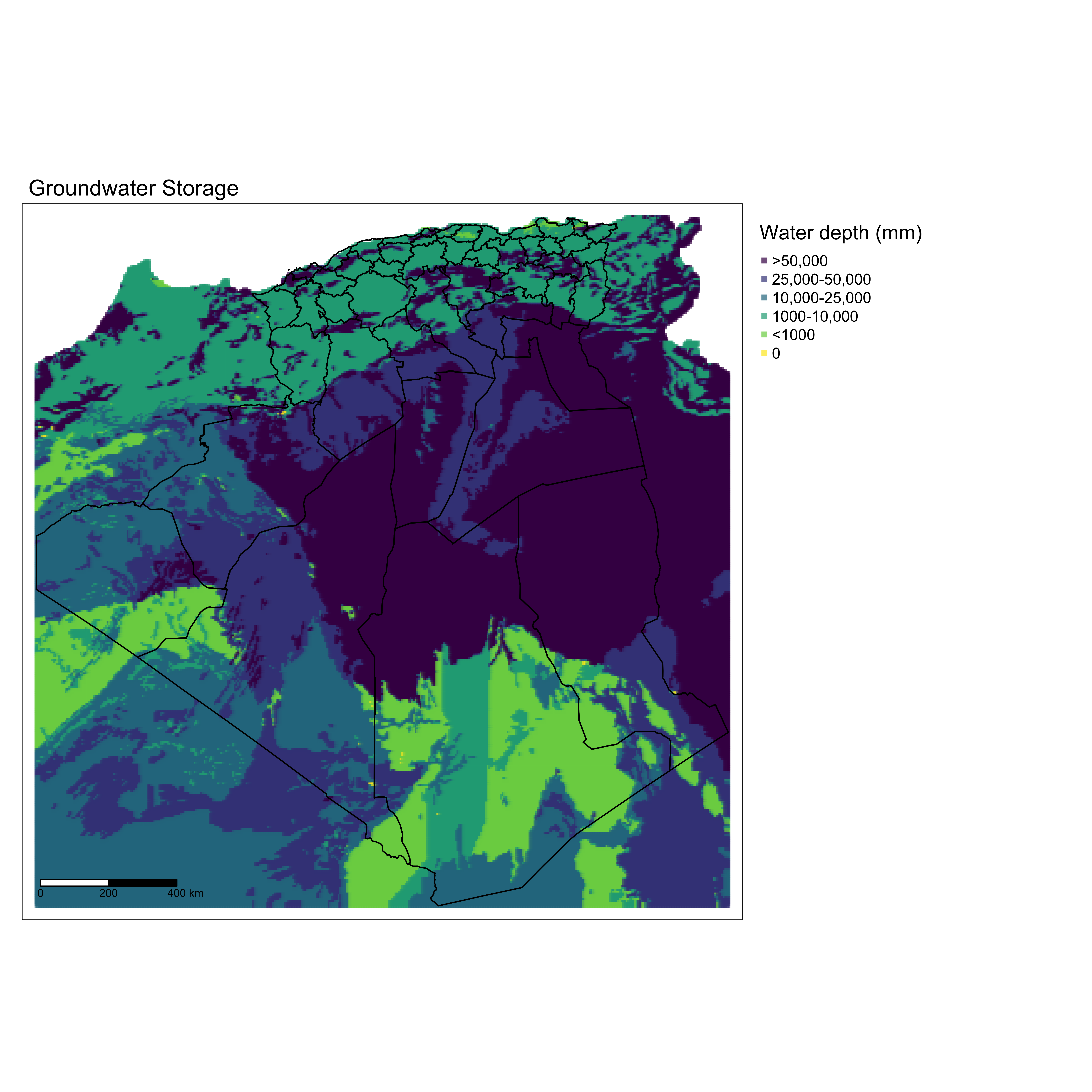
Groundwater storage is mainly located on the south-center of the country. Mainly, El-Oued, Ouargla, Ghardaia, Illizi, Tamanghasset and Adrar. These wilaya benefits from more than 50-meter depth of groundwater storage.
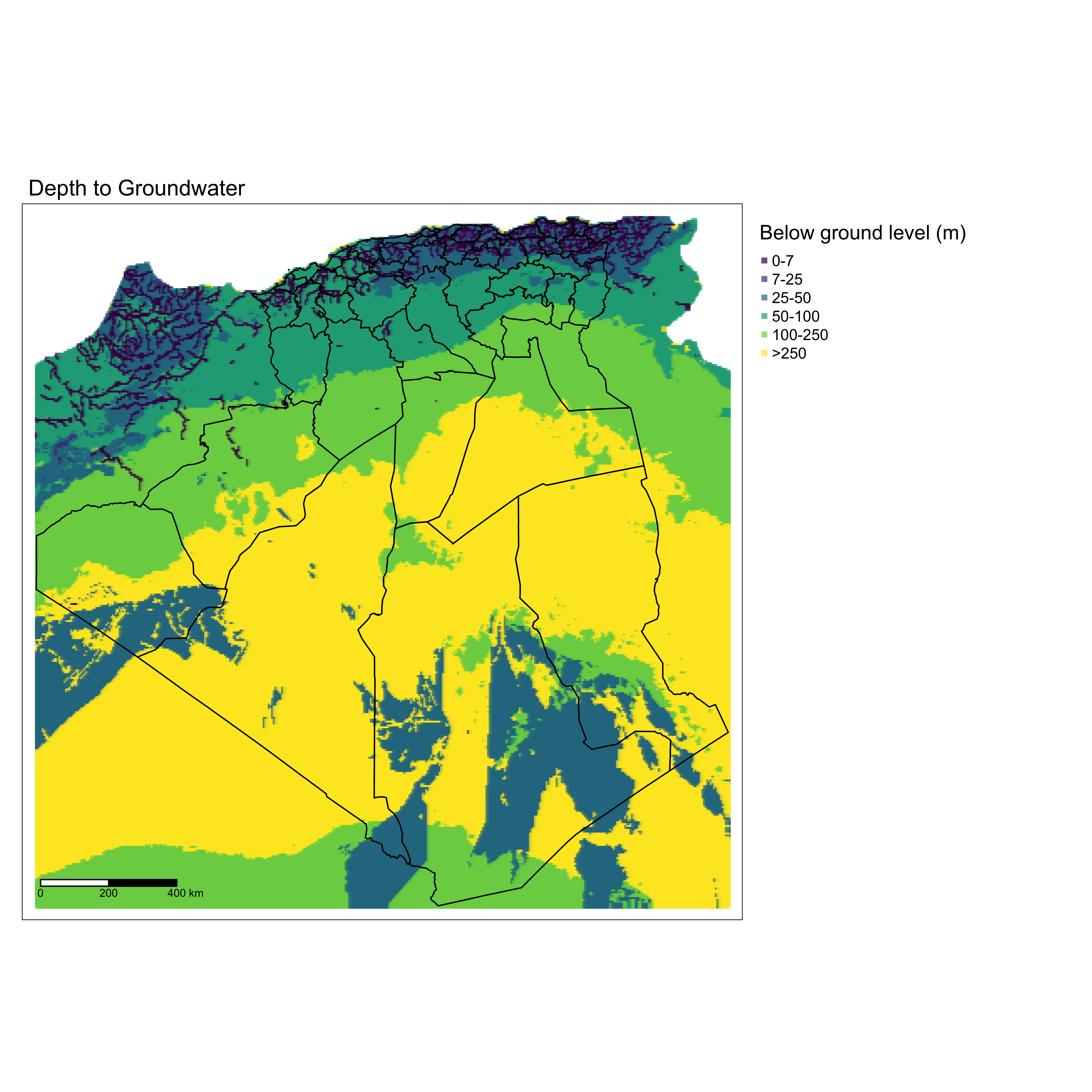
Depth to groundwater in Algeria varies from region to another. However, regions with high groundwater storage known for larger distance of groundwater to surface. The figure above shows that (yellow) wilaya such as El-Oued, Ouargla, Ghardaia, Illizi, Tamanghasset and Adrar groundwater is more than 250 meters below ground level. The depth to groundwater makes it difficult for individuals and small business to exploit water resource. For instance, for irrigation in agriculture sector, water exploitation does not exceed 60-70 m below ground level. Thus, groundwater resource remains out-of-hand for excessive water exploitation.
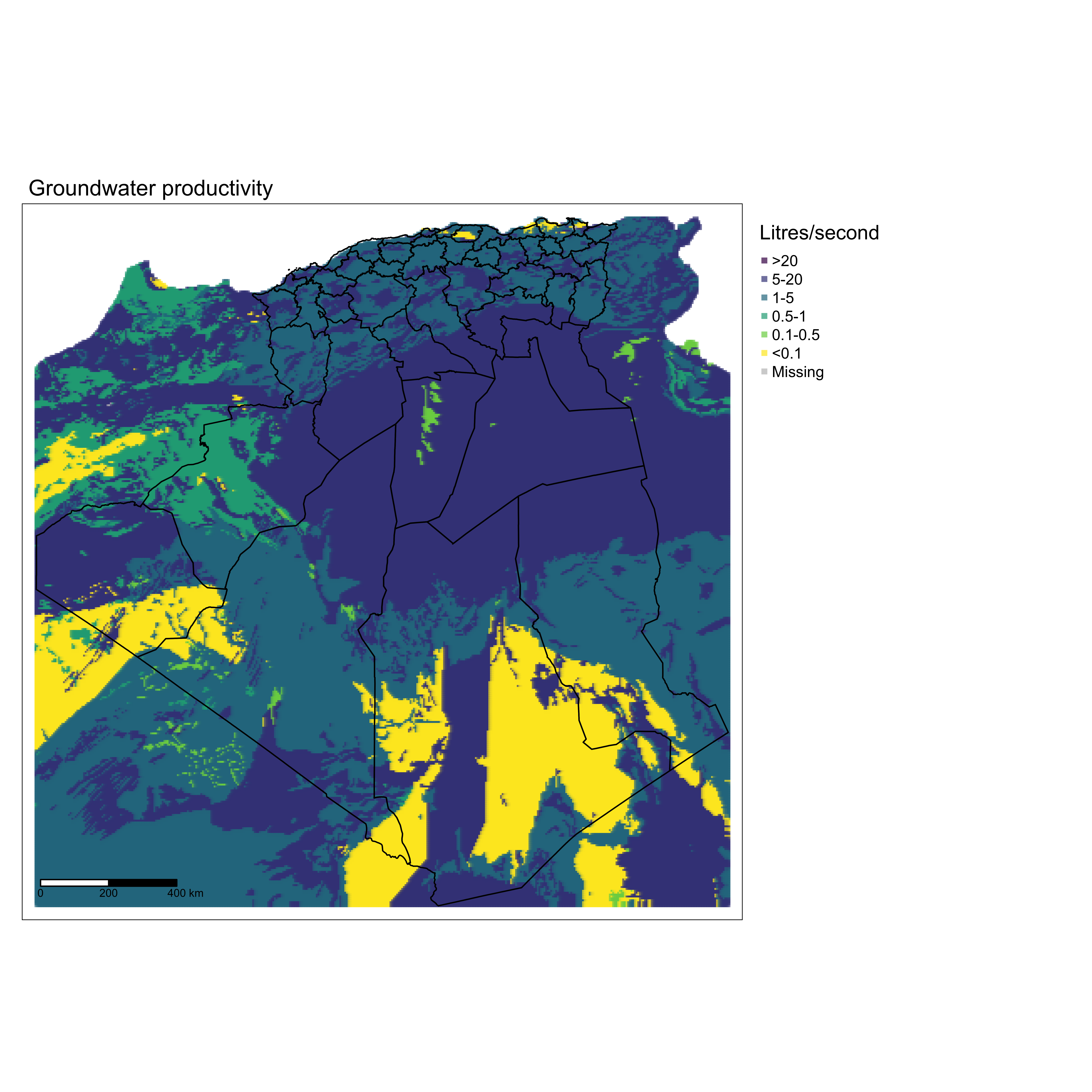
One important aspect of working with groundwater is productivity. High water productivity is observed on the south center of country which exceed 20 liters per second. This demonstrates the very high productivity of groundwater storage, especially in Ouargla, Ghardaia and El-Oued. Although productivity decreases in the north part of the country, productivity remains above 5 liters per second.
Waterways
Additional water source in the country is streams, rivers and lakes. Surface water is more likely to be exploited for household use, irrigation, and industrial use. Rapid population increase, land expansion, increase in industrial activities have led deterioration of water bodies. This has decreased per capita water availability to below 300 m3 per year2. Algeria has about 50 water sites designed and operated as wetlands, covering a total surface area of 30,000 km3. Waterways, on the other hand, is considered an important source of freshwater in the country. Waterways varies from canals, rivers and streams. Rivers is the most dominant waterway in the country and Chief river is the longest river in the country with 700 KM length. However, rivers in Algeria suffer from over exploitation, pollution and low rainfalls rates especially in the Sahara.
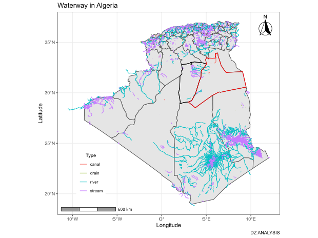
Rivers and streams in the northeast part of Sahara are naturally under the region of Chatt Melghig. Main rivers in these area (Ouargla and Ghardaia) are charetersized by low water storage, dry, and polluted. For instance, Oued Nsa and Oued Metlili witness floods during winter session but rapidly dry.
Reference
MacDonald AM, Bonsor HC, Dochartaigh BÉÓ, Taylor RG (2012) Quantitative maps of groundwater resources in Africa. Environ Res Lett 7(2) :024009 ↩
Neama, M. A., Attia, M., Negm, A., & Nasr, M. (2020). Overview of Water Resources, Quality, and Management in Algeria. In Water Resources in Algeria-Part I (pp. 13-25). Springer, Cham. ↩
Abdellah M, Mohamed H, Farouk D (2018) The implication of climate change and precipitation variability on sedimentation deposits in Algerian dams. Arab J Geosci 11(23):733 ↩